Trail Mountain bike La Bâtie-Rolland - La Bâtie-Rolland - Photo
 tracegps
tracegps

User

© OpenStreetMap contributors
Length
Length
39 km
Max alt
Max alt
458 m
Uphill gradient
Uphill gradient
869 m
Km-Effort
Km-Effort  
51 km
Min alt
Min alt
133 m
Downhill gradient
Downhill gradient
868 m
Boucle
Boucle
Yes
Creation date :
2014-12-10 00:00:00.0
Updated on :
2014-12-10 00:00:00.0

(1 Reviews)

Mountain bike
Mountain bike
4h00
Difficulty : Difficult

Scan this QR Code to open this trail in the SityTrail application

FREE GPS app for hiking

Logo SityTrail SityTrail

IGN / Geographical institutes

Download SityTrail from the App Store Download SityTrail from Google Play

Logo SityTrail SityTrail World

The world is yours!

Download SityTrail from the App Store Download SityTrail from Google Play Download SityTrail on Huawei AppGallery

About

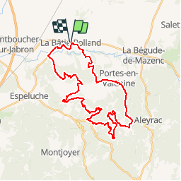
Trail Mountain bike of 39 km to be discovered at Auvergne-Rhône-Alpes, Drôme, La Bâtie-Rolland. This trail is proposed by tracegps.

Description

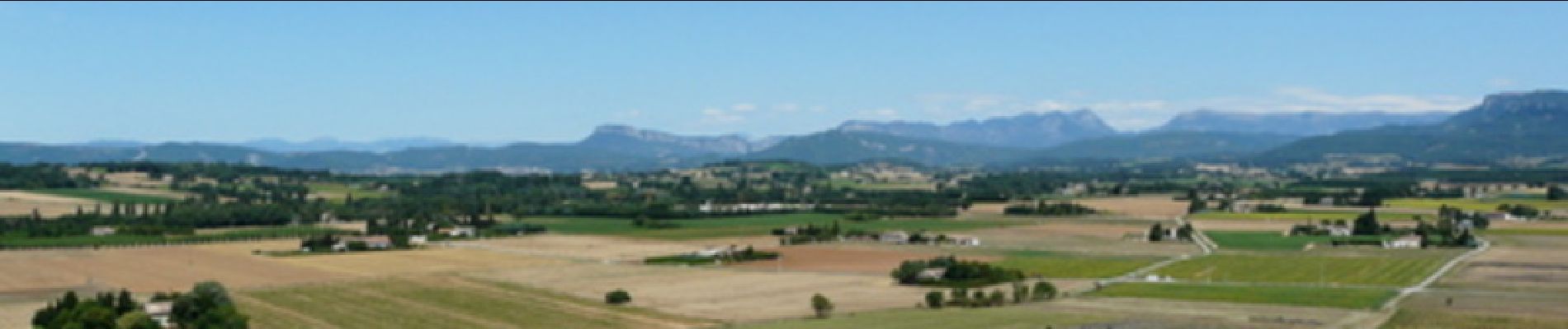
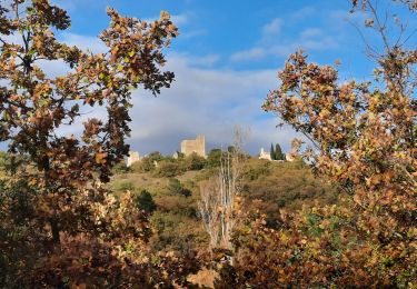
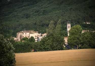
La Bâtie-Rolland se trouve à 10 km à l'est de Montélimar autour d'une colline située au centre de la plaine de la Valdaine, parcourue par le Roubion, le Vermenon et le Jabron.(Wikipedia)

Elevation profile

Photos

Positioning

Country:
France
Region :
Auvergne-Rhône-Alpes
Department/Province :
Drôme
Municipality :
La Bâtie-Rolland
Location:
Unknown
Start:(UTM)
648056 ; 4935036 (31T) N.

Comments

Please log in to post a review or rate the element


Essai Bourg-Saint-Andéol


Trails nearby

Trail Walking Portes-en-Valdaine - GPX-Rando-Plaine-Portoise-nouvelleversion - Photo
Walking
GUIDE
thonyc

Walking

Easy
(1)
Portes-en-Valdaine, Auvergne-Rhône-Alpes, Drôme, France
7.1 km | 8.2 km-effort
2h 0min
Yes
Trail Walking Portes-en-Valdaine - Portes-en-Valdaine Serre-de-Mirabel 11km. - Photo
Walking
chancha

Walking

Difficult
(1)
Portes-en-Valdaine, Auvergne-Rhône-Alpes, Drôme, France
10.8 km | 14.7 km-effort
3h 20min
Yes
Trail Mountain bike Puygiron - Puygiron VTT n°5 - Photo
Mountain bike
tracegps

Mountain bike

Very difficult
(1)
Puygiron, Auvergne-Rhône-Alpes, Drôme, France
47 km | 60 km-effort
3h 0min
Yes
Trail Walking Montboucher-sur-Jabron - 20240428 Rando vieux  - Photo
Walking
Havani

Walking

Very easy
Montboucher-sur-Jabron, Auvergne-Rhône-Alpes, Drôme, France
6.1 km | 6.5 km-effort
5h 17min
Yes
Trail Walking Rochefort-en-Valdaine - tmpWriteApidae_267713_fr - Photo
Walking
GUIDE
thonyc

Walking

Easy
Rochefort-en-Valdaine, Auvergne-Rhône-Alpes, Drôme, France
7.3 km | 10.3 km-effort
2h 30min
Yes
Trail On foot Portes-en-Valdaine - Rando des 15 en courant #26 - Photo
On foot
Julie LABBE

On foot

Medium
(1)
Portes-en-Valdaine, Auvergne-Rhône-Alpes, Drôme, France
19.4 km | 27 km-effort
6h 9min
Yes
Trail Walking La Touche - La Touche : Les Citelles et Serre Pointu 12km - Photo
Walking
chancha

Walking

Difficult
La Touche, Auvergne-Rhône-Alpes, Drôme, France
12 km | 16.6 km-effort
4h 3min
Yes
Trail Walking La Touche - La Touche Mastaize 9km - Photo
Walking
chancha

Walking

Difficult
La Touche, Auvergne-Rhône-Alpes, Drôme, France
8.6 km | 10.7 km-effort
3h 24min
Yes
Trail Walking Espeluche - 2022-10-20_15h14m37_GPX-Bois-Jamot-Espeluche - Photo
Walking
chancha

Walking

Medium
(1)
Espeluche, Auvergne-Rhône-Alpes, Drôme, France
11.3 km | 15.4 km-effort
3h 28min
Yes


Close
My subscriptions